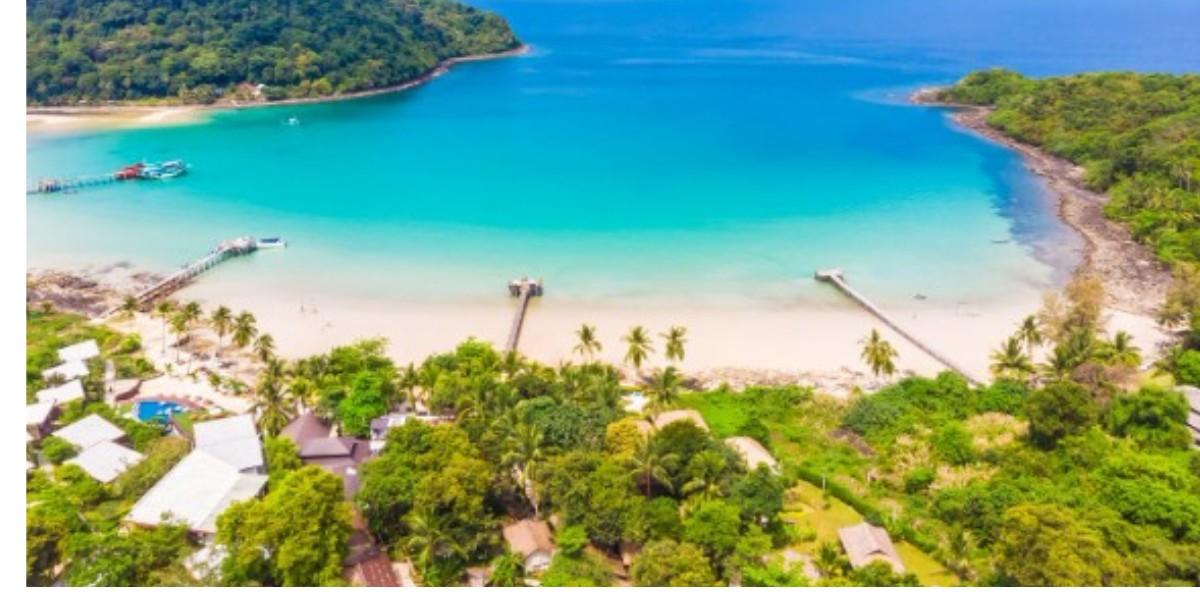
"The northern cluster, home to Port Blair (the capital), and the most visited islands like Havelock (Swaraj Dweep), Neil (Shaheed Dweep), and Ross Island. "
Introduction
Planning a trip to the Andamans without understanding the geography is a bit like booking a flight without checking the destination you'll get there, but you'll miss a lot along the way. The archipelago spans hundreds of islands scattered across the Bay of Bengal, and knowing how they connect helps you plan smarter, save travel time, and prioritise the right stops. This guide walks through the Andaman and Nicobar Islands map so you can plan your itinerary with clarity.
The Big Picture: Two Island Groups, One Territory
The Andaman and Nicobar Islands form a single union territory of India, but geographically they are split into two distinct clusters separated by the Ten Degree Channel:
Andaman Islands – The northern cluster, home to Port Blair (the capital), and the most visited islands like Havelock (Swaraj Dweep), Neil (Shaheed Dweep), and Ross Island.
Nicobar Islands – The southern cluster, largely restricted to tourists due to protected tribal areas and ecological sensitivity, with limited access even for research or administrative purposes.
For nearly all travellers, the itinerary revolves entirely around the Andaman group, which is where the developed tourism infrastructure- hotels, ferries, and attractions is concentrated.
Reading the Andaman and Nicobar Map: Key Zones
Port Blair: The Central Hub
Every trip begins and usually ends in Port Blair, the administrative capital and the only city with a commercial airport. It houses the Cellular Jail, Corbyn's Cove Beach, and the main ferry terminal connecting to outer islands. Most travellers base themselves here for at least the first and last nights of their trip.
North and South Andaman
This region includes attractions like Chidiya Tapu (known for sunset views and birdwatching), Wandoor (gateway to the Mahatma Gandhi Marine National Park), and Baratang Island, famous for its limestone caves and mud volcanoes roughly a half-day journey north of Port Blair by road and boat.
Havelock Island (Swaraj Dweep)
Located about 2–3 hours from Port Blair by ferry, Havelock is the beach and diving capital of the archipelago, home to the renowned Radhanagar Beach and numerous scuba-diving centres.
Neil Island (Shaheed Dweep)
A shorter, quieter island typically visited en route to or from Havelock, known for Bharatpur Beach, Laxmanpur Beach, and the natural rock bridge formation.
Ritchie's Archipelago and Beyond
Smaller clusters of islands around Havelock and Neil offer additional snorkelling and diving spots for travellers looking to venture further off the standard circuit.
Why the Map Matters for Trip Planning
Understanding the layout on the andaman and nicobar map helps with three practical things:
Sequencing your itinerary – Most travellers move from Port Blair → Havelock → Neil → back to Port Blair, minimising backtracking.
Estimating travel time – Inter-island transfers depend entirely on ferry schedules, which can range from 1.5 to 3 hours depending on the route and vessel type.
Choosing your base wisely – Since Port Blair anchors both your arrival and departure, a comfortable, centrally located stay here matters more than travellers often expect.
Basing Yourself in Port Blair
Given that most itineraries begin and end in the capital, your choice of accommodation in Port Blair sets the tone for the whole trip. Mansha Hotels offers two well-established properties in the city, combining comfortable rooms and suites with an in-house pool, spa, and dining options a convenient base whether you're arriving late from the mainland or catching an early ferry to Havelock. Built on the entrepreneurial vision of Mr. Abdul Salam, the brand has become one of the most recognised names in Port Blair's hospitality scene.
Practical Tips for Navigating the Islands
Download offline maps before travelling, as mobile connectivity is patchy outside Port Barhair and major towns.
Book ferry tickets in advance, especially during peak season, since seats fill up fast on popular routes.
Factor in buffer time between island transfers weather can delay departures.
Keep a physical map or printed itinerary as backup, since signal loss is common between islands.
Final Thoughts
The Andaman and Nicobar Islands map reveals a territory far larger and more varied than most travellers expect, with only a fraction of it open to tourism. By understanding how Port Blair connects to Havelock, Neil, and the surrounding attractions, you can plan a smoother, more efficient trip and choose your base accordingly.
Frequently Asked Questions
1. How many islands in Andaman and Nicobar are open to tourists?
Ans.Only a small number of islands within the Andaman group such as Havelock, Neil, and Ross Island are open to general tourism; most Nicobar islands are restricted.
2. How do I travel between islands shown on the Andaman map?
Ans. Government and private ferries connect Port Blair to Havelock, Neil, and other islands; tickets should ideally be booked in advance during peak season.
3. Is Port Blair the best starting point according to the Andaman and Nicobar Islands map?
Ans. Yes, since it houses the main airport and central jetty, nearly all itineraries begin and end in Port Blair.